
Unlock Survey Accuracy with Ground Control Points (GCPs): A Guide for Drone Pilots and Survey Professionals
In the realm of aerial surveying and drone mapping, achieving high precision and accuracy is essential for producing reliable and actionable data. Ground Control Points (GCPs) are a fundamental tool in ensuring that your survey data is accurately aligned with real-world coordinates. This guide delves into the significance of GCPs, how they enhance survey accuracy and practical tips for effectively implementing them in your projects.
What Are Ground Control Points (GCPs)?
Ground Control Points (GCPs) are specific locations on the ground with precisely known geographic coordinates (latitude, longitude and elevation). These points act as reference markers that help anchor and align the digital models and maps generated from drone imagery. By providing a fixed reference, GCPs enable you to correct distortions and align the drone data with real-world spatial coordinates.
Why do we need GCPs?
While GPS accuracy has improved, it can still be affected by factors like satellite geometry, signal blockage and atmospheric conditions, leading to errors as high as 5m. Ground control points (GCPs) provide fixed, known locations that help correct and validate GPS data, ensuring precise measurements. This is crucial for applications that demand high accuracy, such as engineering and construction.
How do GCPs work?
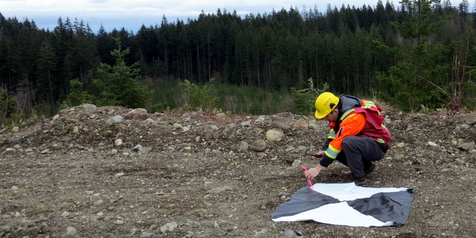
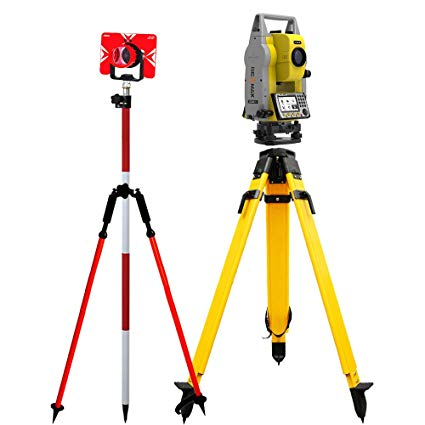
Ground control points (GCPs) work by providing fixed, accurately surveyed reference locations on the ground that enhance the precision of aerial data collected by drones. Before a drone flight, GCPs are established using high-precision GPS or total stations, marking these points with identifiable features for easy visibility. During the flight, the drone captures imagery and data over the designated area. Afterward, photogrammetry software processes the collected images, utilizing the known coordinates of the GCPs to georeference the data and correct any positional inaccuracies caused by the drone’s GPS. Typically, marker accuracy is impressive, with horizontal (XY) precision <5-10mm and vertical (Z) accuracy <10mm. This high level of precision is crucial for applications requiring reliable data, ensuring that the resulting maps or 3D models accurately reflect real-world geography.
Best Practices for Choosing GCPs
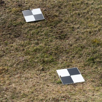
- High-Contrast Patterns: Use GCPs with high-contrast patterns, such as checkerboards or crosshairs. These patterns are easily recognizable in images and help reduce ambiguity about the exact location of the point.
- Durable Materials: Opt for materials that are weather-resistant and durable. Common materials include vinyl, concrete or plastic. Ensure that the GCPs are robust enough to withstand environmental conditions throughout the survey.
- Size: The size of ground control points (GCPs) should be considered in relation to the drone's flight height to ensure effective visibility and accuracy. Generally, larger GCPs are recommended for higher flight altitudes, as they need to be distinguishable in aerial imagery.
Best Practices for Planning GCPs
- Even Distribution: Distribute GCPs evenly across the survey area. Place them at various locations including the edges and center of the site, as well as different elevations if the terrain is varied. This helps to minimize distortions and ensure comprehensive coverage. Atleast 5 GCPs should be present within a processable area to get the best accuracy.
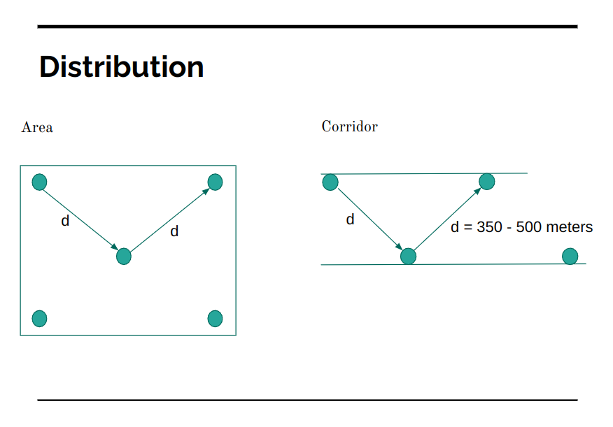
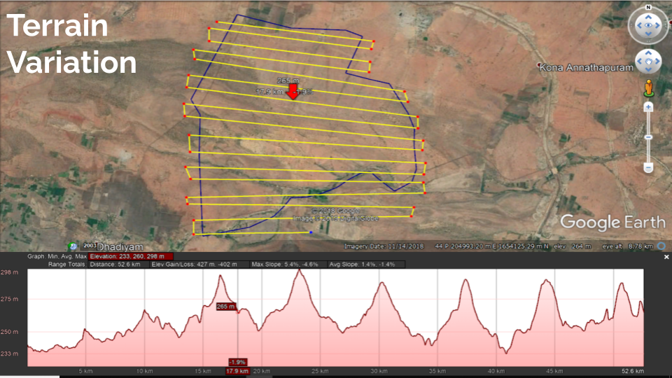
- Terrain Variation: Terrain variations must be taken into account when planning ground control points (GCPs). In undulated landscapes, it's essential to distribute GCPs across features like ridges and valleys to achieve the necessary height accuracy. When dealing with complex topography, increasing the number of GCPs can significantly enhance the accuracy of the reconstruction, ensuring that the final data reflects the true contours and elevations of the area. By strategically placing GCPs in such varied terrain, drone pilots can improve the overall quality and reliability of their survey results.
GCP Placement Guidelines
When placing Ground Control Points (GCPs), careful consideration of location is crucial for achieving accurate survey results.
- Avoid placing GCPs under trees, as foliage can obstruct GPS signals, leading to inaccuracies.
- Positioning GCPs near busy roads can introduce noise and interference, compromising data quality.
- Inaccessible areas, such as dense forests or steep hills, can complicate retrieval and verification processes, making it difficult to ensure GCP accuracy.
- Placing GCPs too close to the edge of the Area of Interest can result in alignment issues during data processing.
To enhance accuracy, ensure that GCPs are positioned uniformly, as described above. This strategic placement enhances the reliability of the data and ensures that the collected information accurately represents the entire landscape.
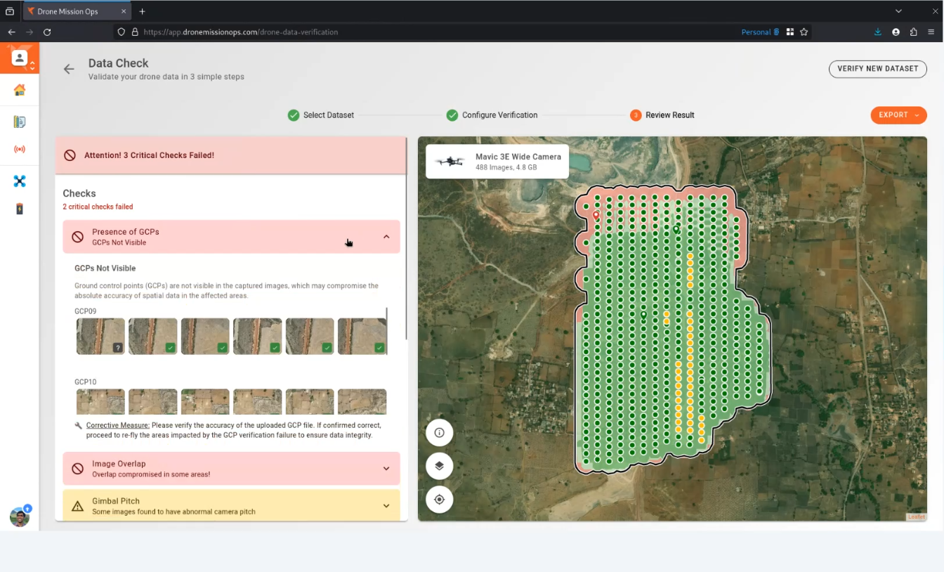
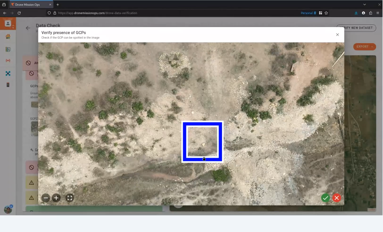
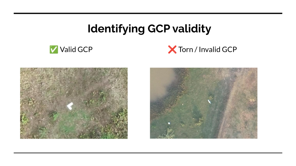
GCP Verification
After placing the GCPs, verify that they are captured in the drone images. Ensure that each GCP is visible in multiple images from different angles to facilitate accurate detection and measurement. Verify GCPs on-field with Drone Mission Ops' Data Check feature in just 3 simple steps.
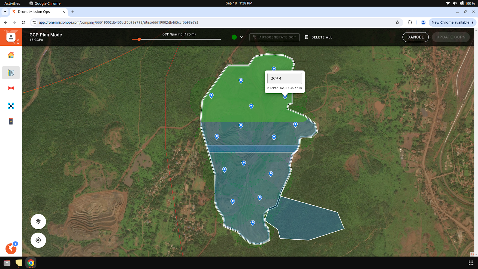
Streamline GCP Placement with DMO's Auto-Generate Feature
Our software solution Drone Mission Ops, features an auto-generate function for Ground Control Points (GCPs), streamlining the placement process. By analyzing the terrain, the software intelligently identifies optimal locations for GCPs, ensuring accuracy and efficiency. This automated approach not only saves time but also enhances the reliability of your survey data, making it easier to achieve precise geospatial models.
Conclusion
Ground Control Points (GCPs) are indispensable tools for achieving high accuracy in aerial surveying and mapping. By understanding the importance of GCPs, implementing them effectively and following above practices, you can ensure that your survey data is precise, reliable and aligned with real-world coordinates.
